The Craft: Engineering Features That Respect Time and Space

The development of a wildfire risk classifier provides an instructive example of how geospatial intelligence projects evolve from raw data collection to actionable insights. A structured review of our second phase of work, focused on feature engineering, highlights several distinct lessons that are broadly applicable to GeoAI projects.

Temporal representation was the first challenge. Wildfire risk is inherently dynamic, unfolding over time rather than at isolated moments. Raw sensor readings only provide snapshots, which fail to capture patterns such as sustained heating or cumulative dryness. By introducing rolling averages of temperature, humidity, and wind speed, the classifier was able to recognize persistence in conditions. Short-term deltas provided awareness of accelerating changes that often precede ignition. Encoding cyclical time such as hour of day or day of week allowed the model to align with known diurnal and seasonal fire patterns. These temporal features ensured that the model’s perspective aligned with how risk accumulates and fluctuates.

Spatial context proved equally important. Fires do not emerge in isolation, and sensor data must be interpreted within its surrounding environment. By aggregating readings across nearby sensors within one or two kilometers, we introduced consensus checks that improved robustness. Encoding land use and eco-region categories further refined the context, since vegetation type and ground cover strongly influence ignition and spread. Adding explicit geospatial information transformed the model from a point predictor into one capable of situating conditions within a landscape. Spatial awareness significantly reduced false positives that would otherwise arise from anomalous single-sensor readings.

Domain-derived interactions added further depth. Wildfire science offers relationships that cannot be inferred from raw data alone. Heat has greater significance when paired with high vegetation density, while wind combined with low humidity increases risk of rapid spread. These engineered interactions capture non-linear dynamics that single features cannot explain. In practice, this meant introducing composite variables such as thermal multiplied by vegetation density. By embedding expert knowledge directly into the feature space, the classifier gained explanatory power and produced outputs more consistent with field experience.

Asset proximity required particular attention. The original sensor feed contained discrete bins such as one, five, ten, or thirty kilometers, as well as infinity. While these bins provided a rough indication of distance to the nearest structure, they were poorly suited for continuous modeling. Our solution was to normalize these distances into a scaled score and treat infinite or missing values as absence of assets within fifty kilometers. This change allowed the variable to be meaningfully integrated both in the model itself and in post-decision rule adjustments. Careful preprocessing of categorical or discretized variables proved essential for unlocking predictive value.

The improvements from these engineered features were clear. Evaluation metrics, particularly precision–recall performance at low false-alarm thresholds, improved significantly. Just as importantly, the features aligned with the intuition of field operators. When the model raised risk alerts, the explanations matched observable environmental patterns, increasing trust and acceptance. This alignment between statistical performance and operational interpretability is central to successful deployment.

In conclusion, feature engineering was not a secondary detail but the core craftsmanship of this wildfire intelligence project. Temporal awareness, spatial context, domain-derived interactions, and refined handling of discrete proximity values combined to create a system that reflected the true dynamics of wildfire risk. Together, these elements transformed raw sensor data into actionable intelligence and provided a robust foundation for further advances in modeling and operational integration.
We Built a Reflex-Based Wildfire Agent Using Geospatial Logic

Our wildfire detection prototype emerged from a focused effort to engineer a simple, transparent agent that reacts to geospatial risk in real time. The agent is intentionally minimalist: it does not learn, it does not predict far into the future, and it does not rely on historical trends. Instead, it responds to the present moment, using structured environmental inputs to make binary decisions through a rule engine. This design reflects a deliberate hypothesis—namely, that real-time geospatial reflex agents can offer meaningful alerts even before more complex forecasting systems engage.

Wildfire risk begins with perceptual awareness. The agent collects and processes environmental signals such as thermal intensity, humidity, wind speed, vegetation density, land use classification, and proximity to nearby assets. These inputs are derived from synthetic or mock data sources that mimic satellite feeds, weather APIs, and land cover datasets. The goal is not to recreate Earth observation in full fidelity but to represent spatial risk factors in a form that is immediately usable by rule logic. Each percept corresponds to a key risk driver independently, with no requirement for aggregation or transformation. This atomicity ensures that every signal remains interpretable and auditable throughout the agent’s lifecycle.

At the core of the agent is its decision engine. This engine houses a small collection of human-readable rules that each test for combinations of environmental thresholds. For example, a rule might check for elevated temperature and low humidity in a forested area and return a message indicating critical risk. If multiple rules are triggered simultaneously, the decision escalates to the highest risk level among them. The agent also assigns a confidence score based on the number of rules that were triggered. Importantly, each rule is associated with a name, allowing decisions to include an explicit trace of which rules contributed to the alert. This design enforces clarity without introducing stochastic elements.

The agent follows a clear and deterministic control cycle. For each geographic coordinate it evaluates, the agent performs three operations: it perceives current conditions, applies its rule-based decision process, and acts by logging or outputting a structured alert. This cycle reflects a synchronous pattern of operation with no memory or internal state. That makes the agent suitable for repeated deployments on new locations or across a grid of spatial tiles. The absence of external dependencies further ensures that the agent can operate in edge environments with constrained connectivity or processing capabilities.

One of the agent’s defining strengths lies in its transparency. The rules it applies are both readable and tunable, enabling domain experts to adjust them without needing to retrain a model or interpret complex parameters. Alert outputs include the precise set of rules that triggered the decision and can be tuned via environment variables for factors like temperature thresholds or proximity cutoffs. Logging is implemented with industry-standard patterns to support both development and operational deployments. From a control perspective, this architecture allows fire analysts, emergency managers, or geospatial engineers to retain full authority over the behavior of the system.

Looking ahead, this reflex agent serves as the launch point for more complex forms of wildfire intelligence. Future versions will include model-based reasoning that can detect temporal trends, utility-driven agents that weigh trade-offs across competing priorities, and learning agents that refine rules based on observed performance over time. Spatial reasoning modules will be introduced to handle tasks like co-location analysis, hotspot mapping, and buffer evaluation. These capabilities will extend the agent from a local decision engine into a distributed, anticipatory system capable of informing broader incident response strategies.

By embedding decision rules directly into a spatial agent framework, we have demonstrated that meaningful wildfire alerts can be generated without requiring large-scale predictive models. This prototype proves that simple agents can be designed to act fast, speak clearly, and integrate seamlessly into geospatial workflows. It does not solve every problem. But it establishes a working principle: that reflexive, rule-based intelligence has a rightful role in the early stages of wildfire management.

Here’s to the spatial ones: Simple Reflex Agent for Wildfire Detection

Geospatial AI Is Critical for Utilities to Mitigate Wildfires

Source: powermag.com

The increasing frequency and intensity of wildfires, particularly in North America, have posed significant challenges for utility companies. These companies are under immense pressure to mitigate wildfire risks and ensure the safety and reliability of their services. The integration of next-generation geospatial technologies, artificial intelligence (AI), and other advanced technologies has become critical in addressing these challenges.

Geospatial intelligence plays a pivotal role in wildfire mitigation efforts. By leveraging advanced geospatial systems, utility companies can precisely map and monitor high-risk areas. These systems provide real-time data on vegetation density, weather conditions, and topography, enabling utilities to identify potential wildfire hotspots. The ability to visualize and analyze this data allows for more informed decision-making and proactive measures to prevent wildfires.

Artificial intelligence further enhances the effectiveness of wildfire mitigation strategies. AI algorithms can process vast amounts of data from various sources, including satellite imagery, weather forecasts, and historical wildfire data. By analyzing these data sets, AI can predict wildfire behavior, identify patterns, and assess the likelihood of future wildfires. This predictive capability enables utilities to allocate resources more efficiently and implement targeted mitigation measures.

In addition to geospatial intelligence and AI, other advanced technologies are also crucial in wildfire mitigation efforts. Mobile tablets equipped with specialized software allow field crews to access real-time data and communicate seamlessly with control centers. This connectivity ensures that crews can respond quickly to emerging wildfire threats and coordinate their efforts effectively. Furthermore, computer vision technology can be used to detect anomalies in power lines and equipment, reducing the risk of ignition and enhancing overall system reliability.

The integration of these technologies not only improves the operational efficiency of utility companies but also enhances the sustainability of wildfire mitigation initiatives. By leveraging advanced geospatial systems, AI, and other technologies, utilities can make data-driven decisions that minimize the environmental impact of their operations. This approach aligns with the broader goal of achieving a sustainable and resilient energy infrastructure.

In conclusion, the adoption of next-generation geospatial technologies, artificial intelligence, and other advanced technologies is essential for utility companies to effectively mitigate wildfire risks. These technologies provide the necessary tools to monitor, predict, and respond to wildfires, ensuring the safety and reliability of utility services. As the threat of wildfires continues to grow, the integration of these technologies will play a critical role in safeguarding communities and preserving the environment.

Link:

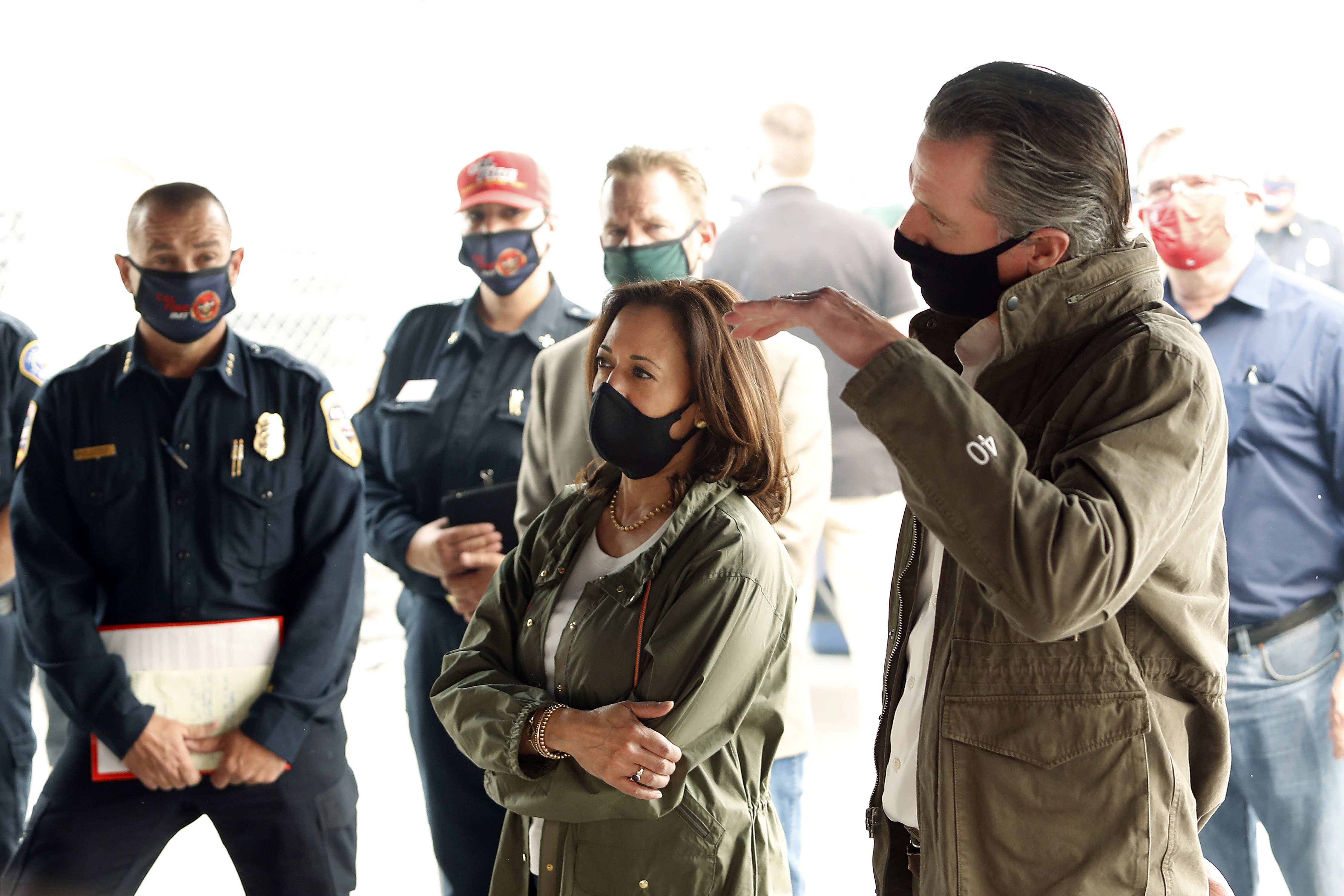
Harris, home in California, gets a look at wildfire damage

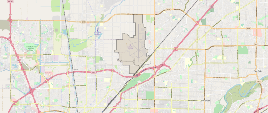
There is no patience for climate-change deniers. The last wildfires were the largest California has ever seen. There was a meeting between California Gov. Gavin Newsom and Donal Trump which took place at McClelland park near Sacramento.

McClelland Airfield, Sacramento © OpenStreetMap contributors

Source: yahoo.com

Links:

Wildfire leaves California’s oldest park too hazardous for visitors

It is too dangerous for visitors to enter the Big Basin Redwoods State Park located in Boulder Creek.

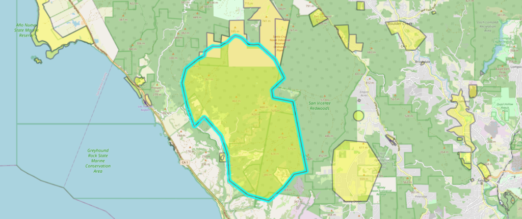
Let us take a look back: In 2009 the Lockheed fire destroyed a huge area of combustible vegetation in Builder Creek and was determined to be an out of control or unattended camp fire the experts said.

Lockhead fire, Boulder Creek, Caifornia © OpenStreetMap contributors

Source: yahoo.com

Links:

Hundreds of thousands of California residents flee as wildfires continue to rage

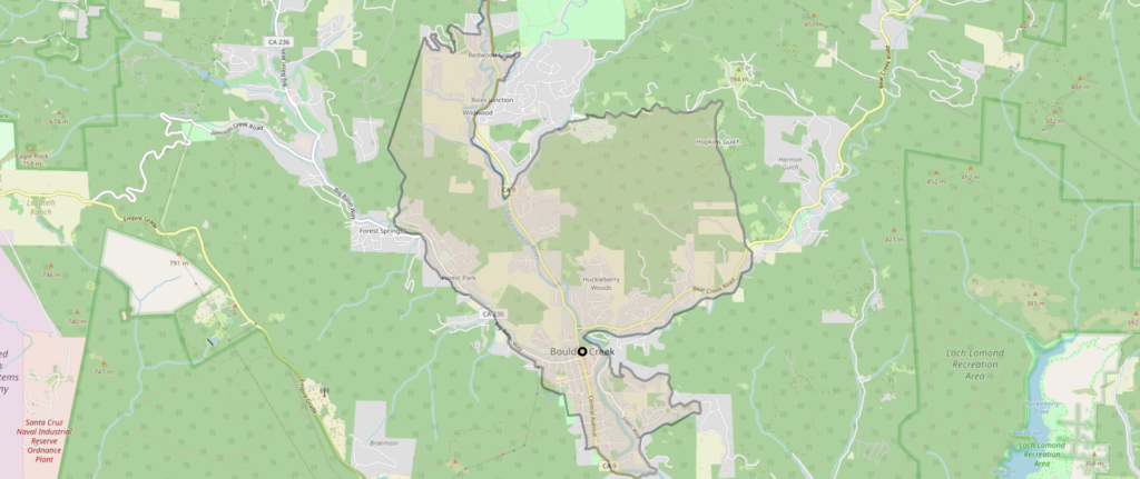
Dry lightning and dusty winds are the results of the fires in California. Red-flag warnings across northern and central california. The fire-fighters are tackling the hotspots in Boulder Creek, California.

Boulder Creek, California © OpenStreetMap contributors

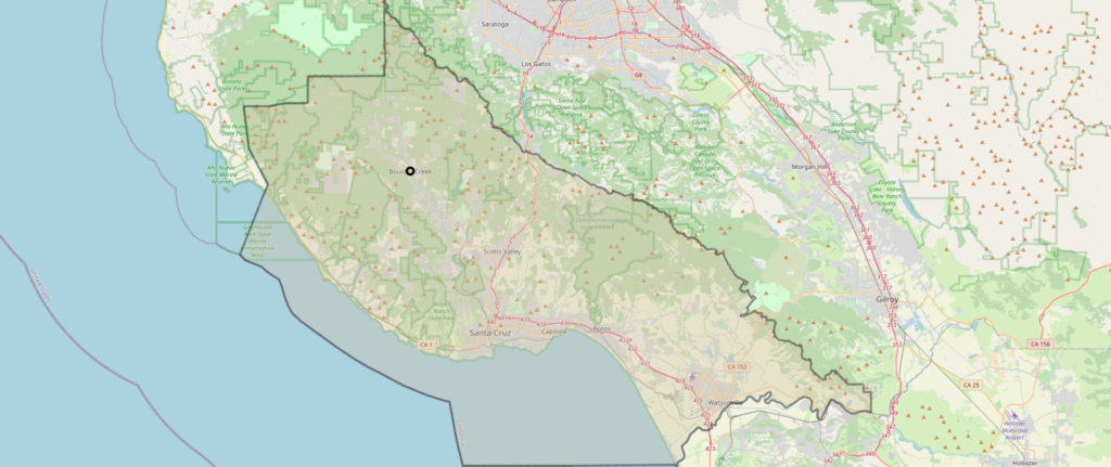
Dangerous fires are also arising from the Santa Cruz Mountains. Usually these fires were ignited by lightning strikes.

Santa Cruz, California © OpenStreetMap contributors

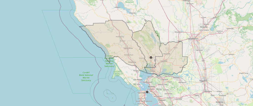
Several counties including Sonoma, Napa and Solano are fighting the fires. Lightning storms could spark new blazes across these counties of Northern California.

Sonoma, Napa and Solano, California © OpenStreetMap contributors

Source: dailymail.co.uk

Links:

California lightning fires advance on towns

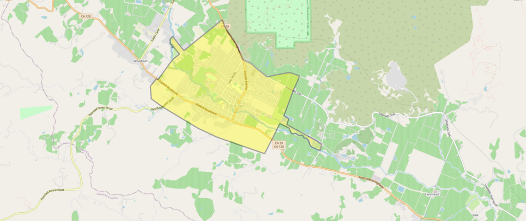
The fire crews deploying water-dropping helicopters made a defensive stand against flames raging in the foothills of the Napa Valley wine region as forecasts called for a return of dangerous high winds and hot weather.

Firefighters were battling the fire, which broke out near the resort community of Calistoga, north of San Francisco.

Calistoga, north of San Francisco © OpenStreetMap contributors

Source: reuters.com

Links: