Satellogic and Quant Data & Analytics Announce Three-Year Agreement

Source: marketscreener.com

In a groundbreaking move that promises to reshape the landscape of satellite imaging and data analytics, Satellogic and Quant Data & Analytics have recently inked a significant three-year contract. This partnership heralds a new era of innovation and collaboration, bringing together the advanced satellite technology of Satellogic with the cutting-edge data analytics capabilities of Quant. In this blog post, we will explore the key aspects of this exciting collaboration and what makes it so special.

The Power of Satellogic’s Satellite Technology

Satellogic is renowned for its state-of-the-art satellite technology, featuring a fleet of small satellites equipped with advanced imaging capabilities. These satellites, commonly referred to as smallsats, are designed to capture high-resolution images of Earth with remarkable detail and precision. Satellogic’s constellation of satellites offers global coverage, allowing for frequent revisits to specific locations and enabling the creation of dynamic, up-to-date datasets.

Quant Data & Analytics‘ Analytical Prowess

Quant Data & Analytics has carved a niche for itself in the realm of data analytics, specializing in extracting meaningful insights from vast and complex datasets. The company employs advanced algorithms and machine learning techniques to analyze data from various sources, providing clients with actionable intelligence and valuable information. The synergy between Satellogic’s satellite imagery and Quant’s analytical prowess holds the promise of unlocking new possibilities across multiple industries.

Key aspects of this collaboration

Data Fusion for Comprehensive Insights

The collaboration aims to leverage the strengths of both entities to provide end-to-end solutions. By fusing high-resolution satellite imagery from Satellogic with Quant’s advanced analytics, the partners intend to deliver comprehensive and valuable insights to clients across industries such as agriculture, environmental monitoring, and infrastructure development.

Real-time Monitoring and Decision Support

The ability to access real-time satellite imagery, coupled with Quant’s rapid data analysis, empowers businesses and governments to make informed decisions promptly. From monitoring crop health to assessing environmental changes, the partnership seeks to provide actionable intelligence in near-real-time.

Customized Solutions for Diverse Industries

The collaboration recognizes the diverse needs of industries and aims to tailor solutions accordingly. Whether it’s optimizing supply chains, enhancing disaster response, or improving urban planning, the combination of satellite data and advanced analytics holds immense potential for addressing specific challenges in various sectors.

Scalable and Sustainable Impact

The three-year contract signifies a commitment to long-term collaboration, emphasizing scalability and sustainability. The partners aim to continually innovate and adapt their offerings to meet growing industry demands, ensuring that the impact of this collaboration extends well beyond the initial contract period.

Summary

The Satellogic and Quant Data & Analytics three-year contract represents a union of cutting-edge satellite technology and advanced data analytics, promising a transformative impact on diverse industries. As the partnership unfolds, we can expect to witness groundbreaking solutions, unlocking new possibilities for businesses, governments, and organizations worldwide. The collaboration sets the stage for a future where the integration of satellite imagery and data analytics becomes a standard for informed decision-making and sustainable development.

Link:
Ardent Achieves Milestone With First FBI Prime Contract Award

Source: pr-inside.com

In a groundbreaking move that signals a new era for Ardent, the renowned technology solutions provider has clinched a prime contract with the Federal Bureau of Investigation (FBI) to deliver cutting-edge geospatial intelligence. This significant achievement marks a milestone for Ardent, propelling the company into the forefront of the technology sector and solidifying its reputation as a key player in the realm of national security.

The Significance of Geospatial Intelligence

Geospatial intelligence (GEOINT) plays a pivotal role in modern security operations, providing a wealth of information derived from analyzing and interpreting data related to geographic locations. From mapping and monitoring to predictive analysis, GEOINT enables agencies like the FBI to make informed decisions, enhance situational awareness, and respond effectively to emerging threats.

Ardent’s Expertise in Technology Solutions

Ardent’s success in securing the FBI prime contract can be attributed to its unwavering commitment to technological excellence. The company has consistently demonstrated its prowess in developing innovative solutions across various domains, from artificial intelligence to cybersecurity. This extensive experience and expertise has positioned Ardent as a trusted partner for government agencies seeking advanced technological solutions.

Key Features of the proposed Geospatial Intelligence Solution

Cutting-Edge Technology

Ardent’s geospatial intelligence solution leverages the latest advancements in technology, incorporating machine learning, data analytics, and real-time monitoring to provide the FBI with a comprehensive and dynamic platform.

Scalability and Flexibility

The scalability and flexibility of Ardent’s solution ensure that it can adapt to the growing needs of the FBI. Whether handling large datasets or accommodating emerging technologies, Ardent’s geospatial intelligence system is designed to scale seamlessly.

Security Protocols

Recognizing the sensitive nature of the data involved, Ardent has implemented robust security protocols to safeguard information at every stage. Encryption, authentication, and secure data transmission are integral components of the company’s commitment to data security.

User-Friendly Interface

Ardent understands the importance of usability in mission-critical applications. The geospatial intelligence platform boasts an intuitive and user-friendly interface, ensuring that FBI personnel can efficiently navigate and extract insights from the vast array of geospatial data.

Ardent’s success in securing the FBI prime contract holds broader implications for national security. By providing the FBI with an advanced geospatial intelligence solution. Ardent is contributing to the enhancement of the country’s overall security infrastructure. The ability to analyze and interpret geospatial data swiftly and accurately empowers law enforcement agencies to stay ahead of emerging threats, protect citizens, and uphold the nation’s security interests.

Conclusion

Ardent’s achievement in securing the FBI prime contract for delivering geospatial intelligence is a testament to the company’s dedication to technological innovation and its commitment to advancing national security. As Ardent continues to push the boundaries of what is possible in the realm of technology solutions, the impact of its work will undoubtedly be felt far beyond the confines of the FBI contract, shaping the landscape of geospatial intelligence and setting new standards for excellence in the industry.

Link:

Transforming Geospatial Intelligence for Good

Source: medium.com

In an era where information is power, the ability to harness and analyze data has never been more crucial. Geospatial Intelligence stands at the forefront of this intelligence revolution, utilizing cutting-edge geospatial technology to make a lasting impact on various intelligence sectors. The commitment to innovation, combined with the dedication to serving the greater good, without earning any prestigious award.

In a world where data reigns supreme, geospatial intelligence stands as a beacon of excellence, proving that geospatial intelligence can not only transform industries, but also be harnessed for the greater good of our nation and its people. Their innovative spirit and commitment to service make them a force to be reckoned with in the world of geospatial technology, and a recognition well-deserved.

Link:

China’s secret naval base in Cambodia

Source: medium.com

In recent years, tensions have been on the rise in the South China Sea, with China aggressively pursuing its territorial claims in the region. One recent development that has caught the attention of analysts is the discovery of a secret naval base in Ream, Cambodia. The base, which was detected through image intelligence, has raised concerns about China’s expanding military presence in the region and its strategic intentions.

Link:

Thousands across Europe protest against the invasion

Thousands of people took to the streets in cities across Europe, and all around the world to protest against Russia’s invasion of Ukraine. In Georgia, a country that was the victim of a Russian invasion in 2008, some 30,000 people turned out in the capital Tbilisi.

Onlookers at a devastated apartment block in Kyiv after an airstrike on February 25. The UN is concerned about the situation in Ukraine, and is receiving increasing reports of civilian casualties. Police detained persons during an anti-war protests in Moscow. Ukraine has already seen thousands of casualties from the long-running conflict with Russia. This conflict broke out in 2014 after Russian-backed rebels seized government buildings in towns and cities across eastern Ukraine. Unluckily, the current aggression of Russia against Ukraine will further aggravate this situation.

Read more @Medium: Thousands across Europe protest against the invasion

Moscow police arrested peaceful anti-war protesters

After a well-educated interior designer had unrolled an anti-war poster on Moscow’s Pushkin Square on Wednesday afternoon, the Moscow police showed up within minutes. He and the peaceful demonstrators condemn the use of Russian troops to invade Ukraine. Russian police arrested other peoples who had spoken out peacefully against the invasion. These peaceful protests stand in strong contrast to the public reaction in Russia when Moscow annexed Crimea from Ukraine eight years ago.

Russian residents protested for the second night in a row across the country. Russian citizens across the country took to the streets for the second night of nationwide protests against their country’s military assault on Ukraine. Thousands of Russians protested the Kremlin’s savage military assault in dozens of Russian cities, despite Russian authorities cracking down on demonstrations. The recorded news media of demonstrations from St. Petersburg showed hundreds of people assembled to call for peace in Ukraine.

Read more @Medium: Protests spot report 23–24 February 2022

Three Reasons Why the Midwest Will Excel in American Defense Innovation

Source: msn.com

The Midwest is refining the innovation process by bringing together academia and defense partners to solve national security challenges. Dual-use technologies that can serve commercial and defense applications are hot in the Midwest. Universities from Wisconsin, Ohio, Indiana, Illinois, Missouri and Iowa represent the Midwest to advance innovation on a national scale. T-REX is home to the nation’s first geospatial innovation center and Moonshot Labs. The future is bright for American defense innovation as entrepreneurs and national labs develop dual-use technologies with support from academia.

Link:

Getting insights from political violence and protests around the world

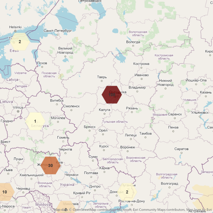
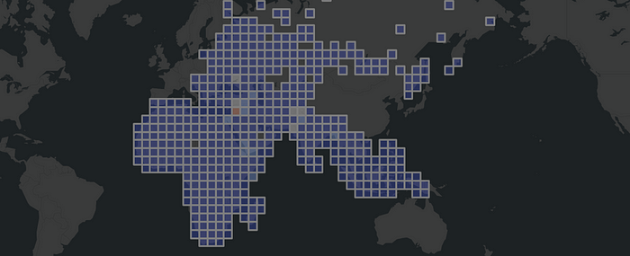
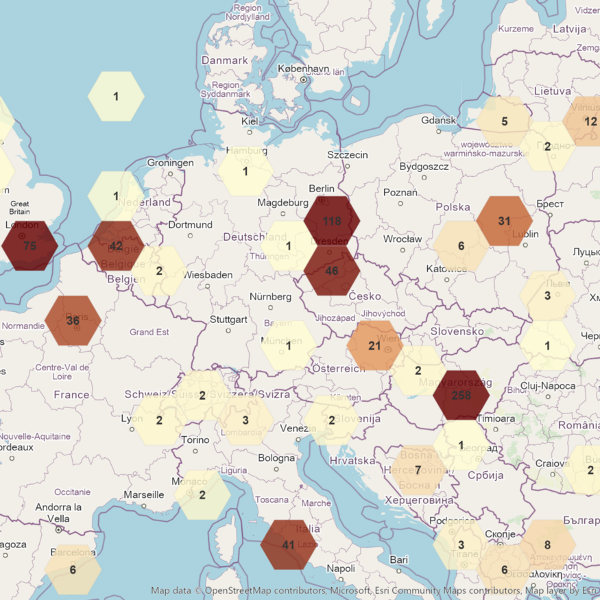
Aggregated non-US ACLED events 2000 — 2020

To achieve political goals, we have seen people and governments using political violence. It includes violence between governments, e.g. war as an intense armed conflict, and violence used against non-state actors, e.g. police brutality. A rebellion is a kind of politically motivated violence of non-state actors against a government. The storming of the United States Capitol was a riot act from non-state actors against the United States Congress.

In this walkthrough we used one of the most widely used analysis OSINT source named ACLED. With the help of spatial binning, we easily recognized historical events between 2000 and 2020 without being an intelligence expert. We have implemented most of the workflows into a GEOINT Python module, mainly to give non-spatial experts a better understanding of the implementation details.

Link:

Nagorno-Karabakh ceasefire strained by recriminations, fighting reports

A bunch of new attacks were launched in and around Nagorno-Karabakh.

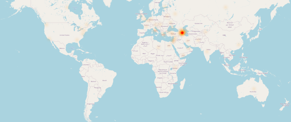
Heatmap of news related to Nagorno-Karabakh, © OpenStreetMap contributors
  • Cardinal Dolan calls for „the shield of faith“ to protect Armenian Christians
  • Baku: new clashes in Nagorno-Karabakh after Washington talks
  • Karabakh: French media pressured over upper Karabakh
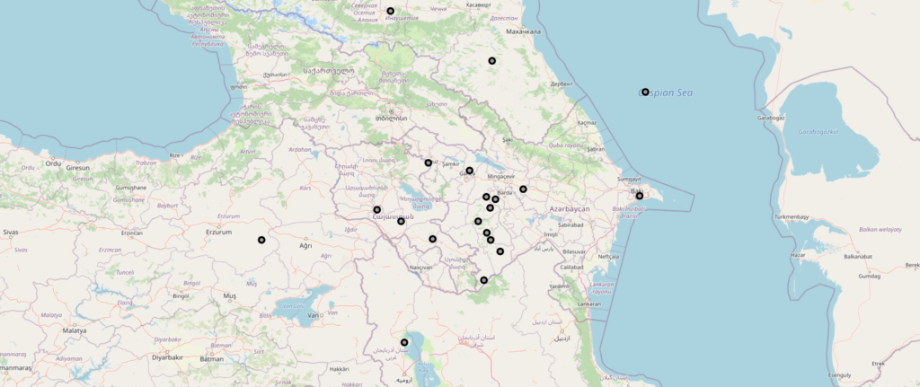
News related to Nagorno-Karabakh, © OpenStreetMap contributors

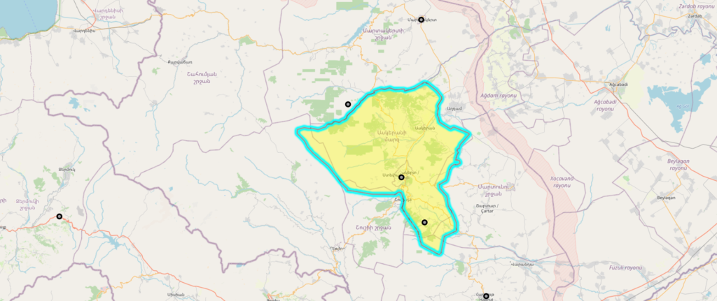
The Khojaly district is located in the occupied Nagorno-Karabakh region of Azerbaijan.

Khojaly District, Azerbaijan © OpenStreetMap contributors

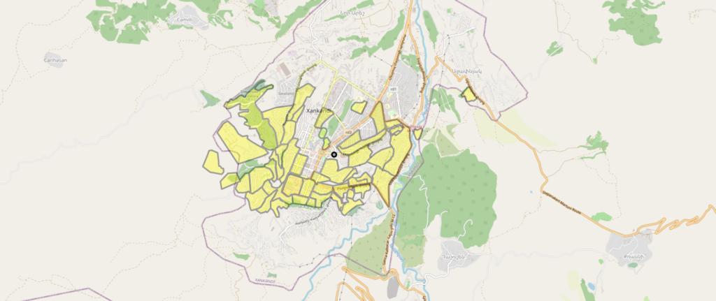
Stepanakert is the capital of the disputed Nagorno-Karabakh region.

Stepanakert, Nagorno-Karabakh, Azerbaijan © OpenStreetMap contributors

Source: reuters.com

Links:

Saudi coalition in Yemen attacks Sanaa targets – Yemeni army, residents

A commander of the 110th Infantry Brigade was killed as a result of the fighting in The Khab and Al-Shaaf district northeast of the Al-Jouf province.

The militants of the Group al-Houthi launched a major offensive to retake positions taken by government forces on Friday east of the city of Al-Hazm, the center of Al-Jouf province, and units of the (110-infantry brigade) were able to thwart the attack. Heavy fighting are taking place in several areas northeast and east of the city of Al-Hazm, while the fighters of the Saudi-led Arab coalition with intensive air strikes targeted mobile and fixed targets of the Houthis.

Yemeni government forces launched a military operation in Al-Jouf, recapturing the strategic Camp Al-Khanjar and important sites, including the Nadoud Mountain Range, and reached near Al-Marazeq, the eastern gate of the provincial capital. The Houthis have controlled the city of Al-Hazm and large areas of the strategic province, large parts of which are located on the border with Saudi Arabia.

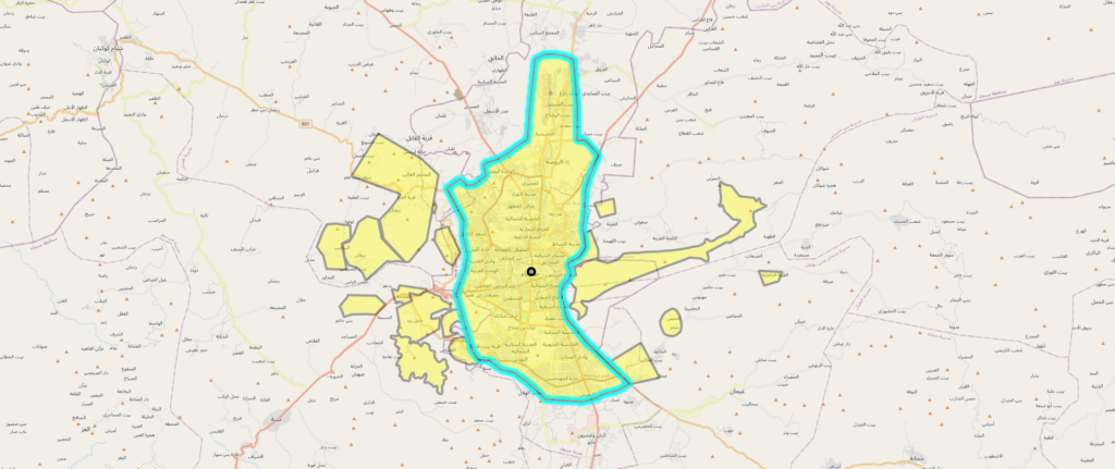
Sanaa, Yemen © OpenStreetMap contributors

Links: